File:GreatBarrierReef-EO.JPG
From Gomerpedia
No higher resolution available.
GreatBarrierReef-EO.JPG (540 × 540 pixels, file size: 50 KB, MIME type: image/jpeg)
| Description |
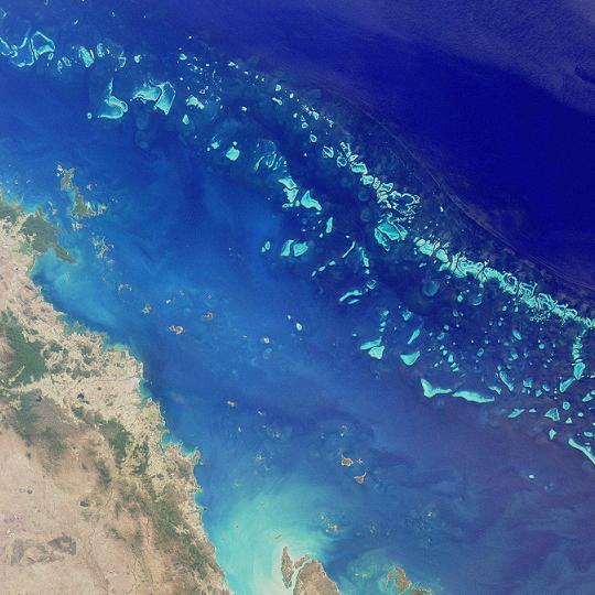
Deutsch: Satellitenfoto eines Teils des Great Barrier Reef nordöstlich von Australien. Es hat eine Länge von gut 2300 Kilometern und erreicht damit eine Ausdehnung vom 10. bis zum 24. südlichen Breitengrad. Hier ein Ausschnitt der Southern Section (auch Mackay Capricorn Reef). Östlich der Stadt Mackay im Bundesstaat Queensland. Es ist der nördliche Abschnitt der Sektion, der in die Central Section (auch Whitsunday Section) übergeht (bzw. vice versa). Der Bildausschnitt umfasst ca. 200×200 km.
English: Satelite image of the Great Barrier Reef
Suomi: Satellittikuva Isosta valliriutasta
Français : Image satellite d'une partie de la grande barrière de corail (NASA)
Italiano: Immagine satellitare di una parte della Grande barriera corallina (foto NASA)
Polski: Wielka Rafa Koralowa - zdjęcie satelitarne
Русский: Участок Большого барьерного рифа — вид из космоса
Svenska: Satellitbild av Stora barriärrevet |
| Date | |
| Source | probably http://photojournal.jpl.nasa.gov/catalog/pia03401 |
| Author | NASA, by MISR |
| Permission (Reusing this file) |
public domain |
| Other versions | Image:GreatBarrierReef-PIA03401.jpg |
.JPG)
originally uploaded to en by User:Seth Ilys
| This file is in the public domain in the United States because it was solely created by NASA. NASA copyright policy states that "NASA material is not protected by copyright unless noted". (See Template:PD-USGov, NASA copyright policy page or JPL Image Use Policy.) | ||
 |
Warnings:
|
File history
Click on a date/time to view the file as it appeared at that time.
| Date/Time | Thumbnail | Dimensions | User | Comment | |
|---|---|---|---|---|---|
| current | 05:52, 23 May 2005 | | 540 × 540 (50 KB) | Shizhao | NASA photograph of the Great Barrier Reef taken by MISR on August 26, 2000. {{PD-USGov-NASA}} da:Billede:GreatBarrierReef-EO.JPG ja:画像:250px-GreatBarrierReef-EO.JPG |
File usage
The following page links to this file: